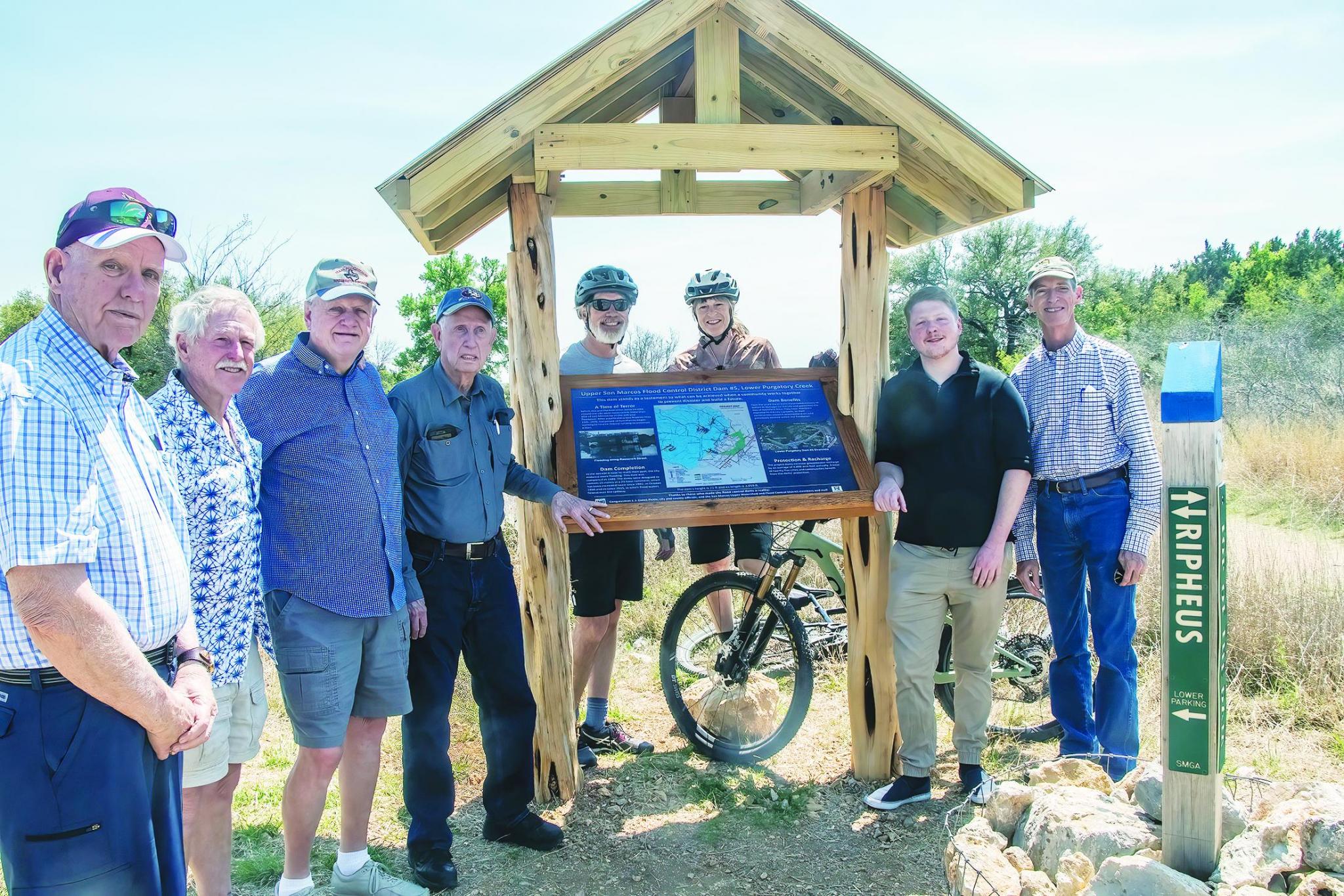
The San Marcos Greenbelt Alliance, in cooperation with the Upper San Marcos Watershed District, recently installed a sign in the Lower Purgatory Greenspace. Above, Joining Ian Long (second from right) were Upper San Marcos Watershed District board members Kyle Brookshier, Rich Earl, Bill Taylor, and Buell Peevy; SMGA board members Scott Henize and Diane Phalen; and Greg Moore, members of both the SMGA and USMWD boards. Below, the new sign at the dam. Photos courtesy of San Marcos Greenbelt Alliance
Newly installed sign in Lower Purgatory Greenspace explains flood control dam
The San Marcos Greenbelt Alliance, in cooperation with the Upper San Marcos Watershed District, recently installed a sign in the Lower Purgatory Greenspace. The sign reviews the history of flooding in San Marcos, which led to the creation of the Watershed District, and describes how the dam and spillway function. The sign was designed by SMGA intern Ian Long with technical assistance from Dr. Rich Earl of the Watershed District. The construction of the sign was carried out by Scott Henize and other members of SMGA.
After a devastating flood in 1970, when lives were lost and Travis Elementary School was inundated with students inside, the citizens of San Marcos decided to act. Thanks to the cooperative efforts of local, state, and federal officials, the Upper San Marcos Watershed District was established. Over many years property and funds were obtained for the construction of the dams. Five dams were constructed on Purgatory Creek and Sink Creek. These dams contain flood waters after heavy rains, releasing the water slowly. Not only does this prevent flooding downstream, but it also allows more water to enter the Edwards Aquifer. The first dam was completed in 1983, with the final one completed in 1991. These dams have prevented deaths and many millions of dollars of flood damage over the years. The Watershed District continues to manage the five dams.
Lower Purgatory, where the new sign is located, is just one of the six natural areas where trails are created and maintained by the San Marcos Greenbelt Alliance. In addition to the role they play in recreation, physical and mental health, and the protection of wildlife habitat, these natural areas also have an important part to play in flood control and water conservation.
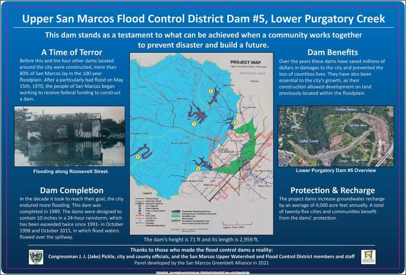
To visit the new interpretive sign, go to the Lower Purgatory Greenbelt trailhead located at Hunter Road and Wonder World Drive. Find the Ripheus trail, then walk up the hill along Ripheus to the crest of the dam (location R8 on the interactive map found on the SMGA website). From this vantage point you can see the dam and the spillway as you read about this flood control structure and how it has helped protect San Marcos from dangerous flooding.
More information about the San Marcos Greenbelt Alliance, the natural areas, and trail maps can be found at www.smgreenbelt.org. SMGA welcomes new members and volunteers to support its vision of creating and conserving an interconnected system of parks and natural areas for our community and future generations.
Moore is a member of SMGA and the Upper San Marcos Watershed District