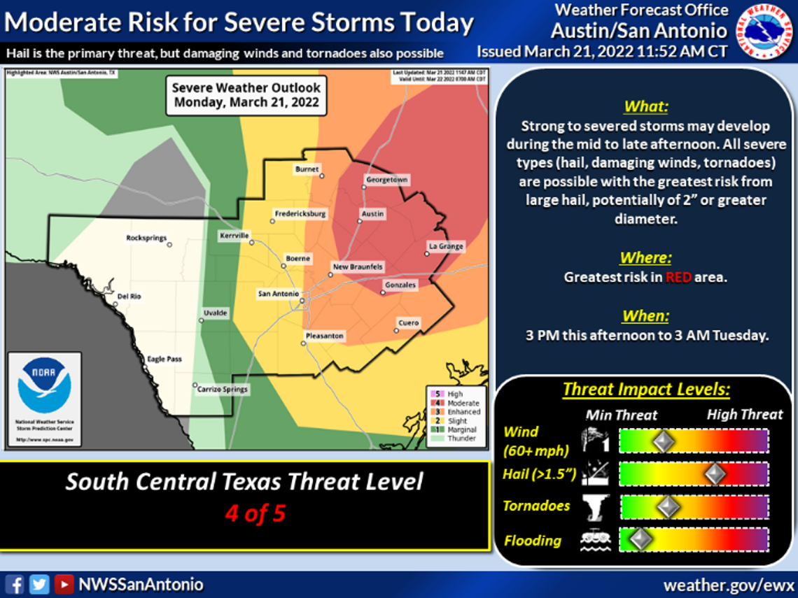
With thunderstorms expected to move through the Interstate 35 corridor during rush hour, the National Weather Service says there’s an increased risk for damaging hail.
NWS has San Marcos and eastern Hays County under a moderate risk for severe storms Monday afternoon — a 4 out of 5 level threat. According to NWS’ severe thunderstorm outlook categories, moderate risk includes the threat of many severe storms that will produce “very large hail, damaging winds, and/or tornadoes.”
“After a round of morning showers and perhaps isolated storms, strong to severe storms are expected mid to late afternoon through this evening into the overnight,” NWS Austin/San Antonio office said. “The storms may form a line and move from west to east. All severe types are possible. While large hail is the primary risk, damaging winds and tornadoes may occur as well.”
Update: The risk for damaging hail has increased for locations along and east of I-35 and north of I-10. The tornado risk remains unchanged. Storms will be moving through the I-35 corridor during rush hour. Please stay weather aware and be prepared to take shelter if necessary! pic.twitter.com/NxeaQp92zw
— NWS Austin/San Antonio (@NWSSanAntonio) March 21, 2022
With the threat of storms during rush hour, NWS offers the following tips for road safety in case of a tornado:
- Get off the road and drive to a designated shelter, basement or safe room.
- The next best option is a small, windowless room or hallway on the lowest floor of a sturdy building.
- Do not seek refuge in a vehicle outside or under an overpass. NWS says a highway overpass doesn’t provide safety from a tornado.
- Do not seek shelter under an overpass or tree. NWS says this puts you at a greater risk of being killed or seriously injured by flying debris from powerful tornadic winds.


