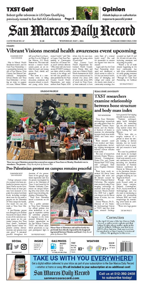


A cold front will blow through Friday morning, bringing rain and the coldest temperatures of the fall so far.
The National Weather Service’s forecast has rain moving through the San Marcos area Friday morning. After the rain, much cooler air will move in for the weekend, NWS said.
Bob Fogarty, meteorologist with the National Weather Service Austin/San Antonio office, said showers and possible thunderstorms are expected to arrive between 6-9 a.m. on Friday.
“We think it’s going to be a line of storms that moves through in kind of a short period of time, maybe a couple hours where there will be a possibility of some storms,” Fogarty said, adding that there’s a low chance of strong to severe storms. “Large hail and damaging winds are the primary hazards that we expect with these storms.”
Fogarty stated that winds could also reach 60-65 mph with the possible thunderstorms as well as quarter-size hail. He said heavy rainfall isn’t expected but a strong storm could produce an inch of rain in a short period of time.
“But we don’t really expect there to be any flooding or issues with it because it should move fairly quickly,” Fogarty said. “Nothing is going to linger. But if you get one of those strong storms, a brief, heavy rain shower, it could be a lot of rain but shouldn’t be flooding rain.”
Fogarty said the rain should move out of the area fairly quickly but strong winds will remain throughout the afternoon.
“Once the front goes through, the winds should shift around to the north and probably 15-25 mph [winds], maybe some gusts around 35 mph during the afternoon,” Fogarty said. “That will probably last much of the day and in the evening time, it will probably calm down.”
The high temperature is expected to reach 71 on Friday but colder air will cause that to lower throughout the afternoon. Lows are expected in the 40s overnight Friday into Saturday. Highs in the upper 50s are in the forecast for Saturday with lows Sunday morning in the mid 30s.
NWS stated that a freeze is “looking more likely over the western and northern Hill Country on Sunday morning.”
Rain chances return Monday with a 50% chance of rain and highs in the upper 50s.