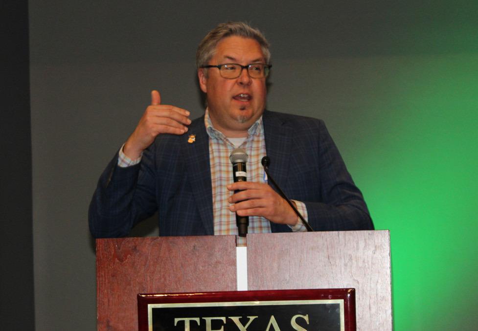
TXST’s Office of Sustainability and Department of Geography and Environmental Studies along with the Barton Springs/Edwards Aquifer Conservation District hosted a Groundwater Symposium on April 2 at the LBJ Student Center. Pictured is Robert Mace, Texas State University’s Meadows Center for Water and The Environment executive director..
Daily Record photo by Shannon West
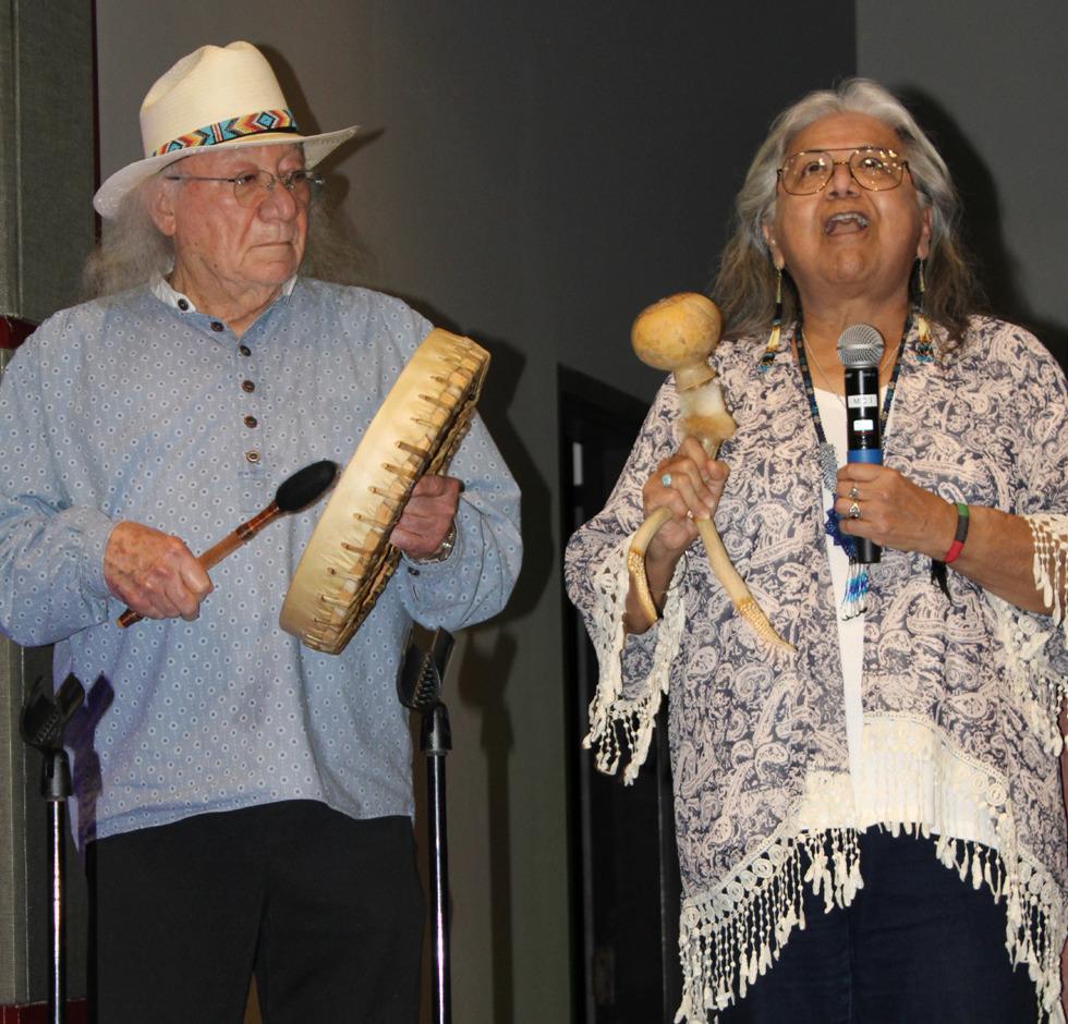
Dr. Mario Garza and Maria Rocha of the Indigenous Cultures Institute are both members of the Miakan/Garza Band and performed a traditional prayer before the speakers came up.
Daily Record photo by Shannon West
Experts teach about the hydrology of local aquifers
This is the second of a two part series on the Groundwater Symposium that occurred at Texas State University on April 2 bringing together the area’s groundwater conservation leaders.
The aquifer’s in the area are complex and vastly different from one another, but all are interconnected. Each impacts the flow for various surface water sources throughout the region and require different regulations for management. Texas State University’s Office of Sustainability and Department of Geography and Environmental Studies, along with the Barton Springs/Edwards Aquifer Conservation District, hosted a Groundwater Symposium on April 2 at the LBJ Student Center to discuss hydrogeology, management and conservation of local aquifers.
Robert Mace, TXST’s Meadows Center for Water and the Environment executive director and chief water policy officer, gave a presentation on the hydrology of local aquifers. Hydrology is the study of the distribution and movement of water both on and below the Earth’s surface as well as the impact of human activity on water availability and conditions.
Mace pointed out the Balcones Escarpment on a topographical map of Texas, which is “this transition from the kind of flat, gulf coastal plain and then suddenly this explosion of topography of the Hill Country.” The Balcones Escarpment runs from Waco to Del Rio. Mace said its origins date back to Pangea, the supercontinent that existed when all of the continents “smashed together” hundreds of millions of years ago.
“Similar to the Indian subcontinent smashing into the Asian continent you get mountain building. You’ve got mountain building in that gray area that’s referred to as the Central Pangean Suture,” Mace said. “That mountain building is aligned with the Appalachian Mountains, which is one of the things that came out of it. Then through this part of Texas it was the Ouachita Mountains, but it was all formed at the same time.”
Mace said the Hill Country was once mountainous, but those mountains eroded away.
“A lot of those sediments eroded into the Permian Basin, but underneath us you’ve got solid basement rock that’s at the edges of the continent. Then on top of that came other sediments including the sediments that created the Trinity Aquifer and then the Edwards Aquifer on top of it,” Mace said. “The next big geological event that happened is called the Laramide Orogeny. Basically it’s the formation of the Rocky Mountains, and it created this giant geological teeter totter where the Old Ouachita Mountain root is the fulcrum of the teeter totter. So everything to the West rose. It’s hard to see those numbers, but you get over to New Mexico, and you’re talking a rise in 5,000 to 6,000 feet. Then towards the Gulf of Mexico, there is an opposite sinking of 5,000 to 6,000 feet.”
Mace talked about the different aquifers, and how they behave. He said the Edwards Aquifer has karst features, meaning that rainfall recharges the aquifer in certain areas. He compared the Edwards Aquifer to a bathtub with a shower head. The water coming out of the shower head represents rain recharging the aquifer, and the overflow prevention feature of the bathtub represents some of the water from the aquifer being released through the springs. He said to think of the drain as one with a dial that allows control of the amount of water released from the tub, which represents pumping of the aquifer.
“If we had no pumping, on an equilibrium basis you would have that flow going out — that overflow drain [that’s coming] out of the springs as the base flow equal to the recharge. Of course the recharge, the rainfall, varies with time. Without any pumping we call that dynamic equilibrium,” Mace said. “But then you start opening up that drain. What happens when the pumping in this case is equal to the recharge coming into this aquifer? … They (the springs) stop flowing. So that’s one of the issues with managing an aquifer.”
Mace then discussed the Trinity Aquifer, which works differently than the Edwards Aquifer, which is composed of the Upper, Middle and Lower Trinity.
“There’s rainfall that’s recharging. You see it (water) moving across those layers. It’s coming out as base flow. Some of it is coming out as spring flows. There’s interaction with the Guadalupe River. There’s Canyon Lake on one side; it’s gaining water from the aquifer, and on the other side it’s losing water to the aquifer. You see it flowing down into the Balcones Fault Zone,” Mace said. “So the Trinity Aquifer in this area is kind of like a leaky bathtub. It’s leaking from itself into the Edwards [Aquifer] where that fault zone is. In addition to the spring flows, and in addition to the pumping that’s going on.”
Mace said aquifers can be split into two categories. There is an unconfined aquifer, or water table aquifer, and a confined aquifer or artesian aquifer.
“So an unconfined aquifer has a water table, also known as a free surface, and a free surface means that it can go up and it can go down. So if there’s a lot of rainfall, [there is] a lot of recharge, [and] it can come up. If there’s not as much, [like during] drought, then water levels go down. If there’s lots of pumping, water levels go down. If pumping decreases, water levels go up,” Mace said, adding that a well in an unconfined aquifer will match the level of the water table. “On the right is a confined aquifer, and this is an aquifer that has a cap on top. So in some ways it’s kind of like taking your natty light and shaking it up, and you pop the top and all this pressure comes out. So in this case, it’s fully saturated. If you drill a well in there, the water level of the well actually rises above the top of the aquifer. It’s under pressure. … These types of aquifers behave very differently.”
Mace said within the same aquifer you can have a confined zone and an unconfined zone.
“There’s also something called a transition zone where as the water levels go up and down, the aquifer can change from unconfined to confined or from confined to unconfined,” Mace said. “There’s really three main aquifer’s here.”
In the Hill Country, Mace said the three main aquifers are the Trinity Aquifer, the Edwards Aquifer and the Carrizo- Wilcox Aquifer.
“Water very dramatically goes into and recharges the Edwards Aquifer,” Mace said. You don’t get that in sandstone aquifers like the Carrizo-Wilcox … Things just move very slow. The age of the water is tens of thousands of years old compared to years and decades in the Edwards. And the Trinity, it kind of depends on what day you hit.”
He said there are parts of the Trinity Aquifer that behave like the Edwards Aquifer and parts of it that behave like the Carrizo-Wilcox Aquifer. He said, because of the different behavior, it can require additional regulation.
Learn more about groundwater at this link txhillcountrywater.wp.txstate. edu/groundwater/ groundwater-importance.