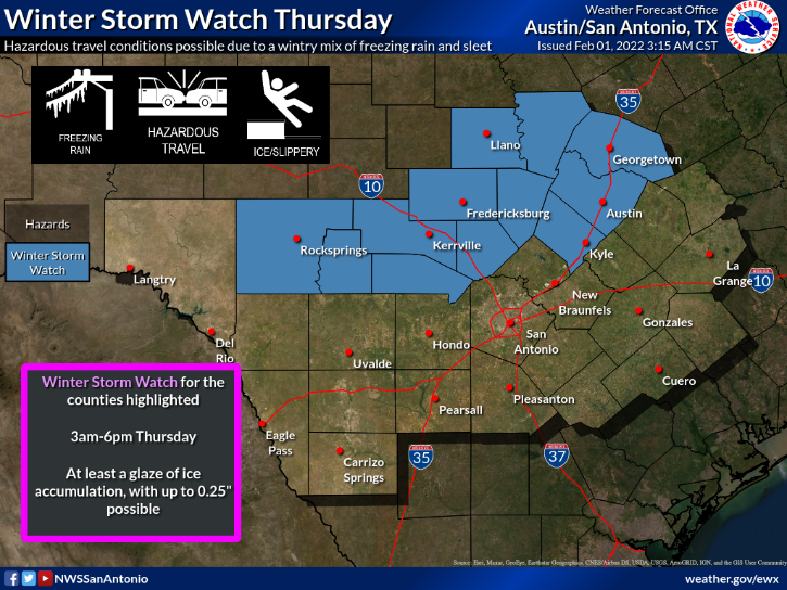
A cold front will blow through the area Wednesday, brining cold temperatures and a winter weather chance. The National Weather Service has issued a Winter Storm Watch, which goes into effect early Thursday morning. Infographic courtesy of National Weather Service Austin/San Antonio
Arctic cold front to blow through Wednesday, Winter Storm Watch issued
San Marcos will see a strong, arctic cold front blow through on Wednesday, bringing with it below freezing temperatures and the possibility of winter precipitation.
The National Weather Service issued a Winter Storm Watch for Hays County, which goes into effect on Thursday at 3 a.m. and last until 6 p.m. NWS meteorologist Aaron Treadway said it’s going to get, “really cold behind the front,” with temperatures reaching a high of 35 degrees on Thursday and low temperatures in the 20s on Friday and Saturday morning.
“It’s going to be very cold those nights regardless of any precipitation chances for San Marcos,” Treadway said. “Those are just the ambient temperatures. The real temperatures if you start factoring in what it feels like — it’s going to be windy behind the front — so we could see wind chills in the teens and possibly even the single digits for Friday morning as the north winds continue behind the front and those temperatures drop into the 20s for lows.”
NWS forecasts state that the cold front is expected to bring the coldest temperatures to the region this winter so far. The severity and impact it has on the area, however, will not be a repeat of the February 2021 winter storm, NWS said.
A chance for a mix of freezing rain and sleet exists on Thursday with a 60% chance wintry mix, according to the NWS. Treadway said San Marcos is on the cusp of seeing possible sleet in the mix.
“As of [Monday afternoon], rain will start in San Marcos Wednesday afternoon into the evening hours. There may be a rumble of thunder for the San Marcos area Wednesday evening but chances of that are pretty low,” Treadway said. “Y’all don’t drop below freezing until some time Thursday morning, so it’s going to be a race on Thursday between precipitation clearing out and the temperatures dropping to that freezing mark.”
Treadway added that the forecast has freezing rain staying just to the north of San Marcos.
“We’re still 48 hours, a little bit beyond that, out from this [cold front],” Treadway said. “That freezing line may retreat more to the north and it be just all rain for [San Marcos]. It may move further to the south and transition more to a wintry mix.”
Travel could be very difficult on untreated roads, especially elevated bridges, overpasses, and roadways, NWS added.
With the possibility of winter weather, Hays County reminds residents to take care of the four Ps: people, pets, pipes and plants. Additionally, the Hays County Office of Emergency Management has coordinated with various entities for warming stations in case massive power outages occur across the county, the county said in a social media post.